China Launches Hi-Def Observation Satellite
| David Perry | | Aug 19, 2014 02:25 PM EDT |
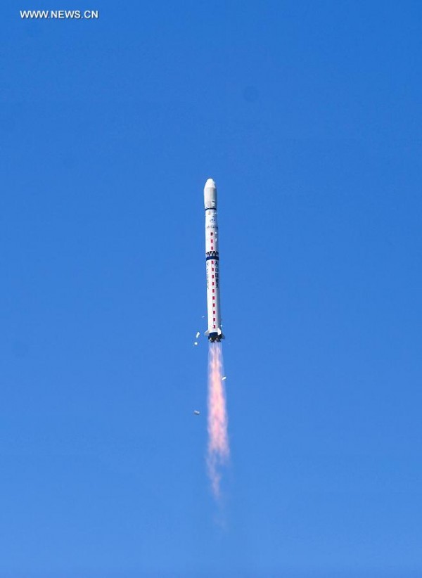
(Photo : www.news.cn) The high-definition Gaofen-2 Earth-imaging satellite takes to the sky over China
China successfully launched its most advanced high-definition Earth-observation satellite on Tuesday. The Gaofen-2, the country's second HD satellite in orbit, launched from the Taiyuan Satellite Launch Center the country's northern Shanxi Province at 11:15 a.m. local time.
The announcement came from the State Administration of Science, Technology and Industry for National Defense.
Like Us on Facebook
Intended for a multitude of uses, including geographic and resources surveys, environment and climate change monitoring, precision agriculture, disaster relief, and city planning, the new satellite is heralded by the state-run Xinhua News Agency as China's most sophisticated yet. "Gao fen" means "high definition" in English.
Atop a Long March-4B carrier rocket, the Gaofen-2 took off into clear skies. It is expected the data it gathers will be used by the country's Ministry of Land and Resources, Ministry of Environmental Protection, and the Ministry of Agriculture. The Gaofen-2 sensors will be able to render in full color objects as small as one meter (a little over three feet) in length.
Chinese authorities plan to send a series of seven "Gaofens" into orbit. The first, Gaofen-1, was launched in April of last year, and made headlines when it was hoped its cameras might aid in the disappearance of Malaysian Flight MH370 that vanished over the Indian Ocean on March 4. Gaofen-1 also provided data on the Lushan earthquake in Sichuan; floods in northeast China; and smog patterns plaguing the Beijing region. China-ally Pakistan utilized the satellite for images after a massive quake devastated its southwestern provinces in September of last year.
Of Gaofen-2, Wu Zhenyu, a researcher with the Development Research Center of the State Council, said the project is expected to strengthen China's remote sensing industry as well as ensure more effective social management.
Also in the payload was the Polish-made satellite BRITE-PL-2, also known as "Heweliusz," that astronomers will use to observe stars brighter and hotter than our Sun.
TagsGaofen-2, Gaofen-1, Chinese satellite, high definition satellite
©2015 Chinatopix All rights reserved. Do not reproduce without permission
EDITOR'S PICKS
-

Did the Trump administration just announce plans for a trade war with ‘hostile’ China and Russia?
-

US Senate passes Taiwan travel bill slammed by China
-

As Yan Sihong’s family grieves, here are other Chinese students who went missing abroad. Some have never been found
-

Beijing blasts Western critics who ‘smear China’ with the term sharp power
-

China Envoy Seeks to Defuse Tensions With U.S. as a Trade War Brews
-

Singapore's Deputy PM Provides Bitcoin Vote of Confidence Amid China's Blanket Bans
-

China warns investors over risks in overseas virtual currency trading
-

Chinese government most trustworthy: survey
-

Kashima Antlers On Course For Back-To-Back Titles
MOST POPULAR
LATEST NEWS
Zhou Yongkang: China's Former Security Chief Sentenced to Life in Prison

China's former Chief of the Ministry of Public Security, Zhou Yongkang, has been given a life sentence after he was found guilty of abusing his office, bribery and deliberately ... Full Article
TRENDING STORY

China Pork Prices Expected to Stabilize As The Supplies Recover

Elephone P9000 Smartphone is now on Sale on Amazon India

There's a Big Chance Cliffhangers Won't Still Be Resolved When Grey's Anatomy Season 13 Returns

Supreme Court Ruled on Samsung vs Apple Dispute for Patent Infringement

Microsoft Surface Pro 5 Rumors and Release Date: What is the Latest?


