Chinese Aerial Drones to Map South China Sea; Might Snoop on Vietnam’s Rebuilt Islands
| Arthur Dominic Villasanta | | Sep 24, 2016 09:39 PM EDT |

(Photo : China TopRS Technology Co.) ZC-5 aerial drone.

(Photo : DigitalGlobe) Vietnam's island building in the Spratlys.
A state-owned aerial surveying firm will soon begin an extensive aerial survey to map what China claims are the islands and features in the disputed South China Sea and East China Sea that belong to it.
China TopRS Technology Co. Ltd. will use two of its largest unmanned aerial vehicles (UAVs) or aerial drones to conduct the aerial mapping covering thousands of kilometers of ocean. The company will use its long-range ZC-5B and ZC-10 UAVs to map both seas, said Li Yingcheng, general manager.
Like Us on Facebook
China TopRS is a wholly owned subsidiary of the Chinese Academy of Surveying and Mapping, a government agency engaged in basic theoretical studies and applications in surveying, mapping, geoinformation and related disciplines.
These drones are the largest in the company's UAV fleet. The ZC-5B is a twin-boom UAV with an inverted V-tail. Its two-blade propeller is driven by a pusher engine mounted at the rear of the fuselage. ZC-5B, which is two meters long and can loft a five kilogram payload, is made of carbon fiber and is intended for long endurance surveillance.
This UAV was specifically designed to map and survey open sea reefs. It has an operating range of 1,400 km and can work up to 30 hours.
Not much information has been revealed about the ZC-10 but since China TopRS designates its UAVs by increasing complexity, the ZC-10 will likely be larger than the ZC-5B with longer range and a heavier payload.
Li said the UAVs are equipped with China's Beidou satellite navigation system and can cover in one mission an area as large 80 nautical miles and partially areas spread across 1,500 nautical miles.
China TopRS will probably avoid the airspace over the islands and reefs held by Vietnam or face the risk of its UAVs being shot down. The Vietnamese have rebuilt 10 islands in the South China Sea over the past two years and have deployed surface-to-air and surface-to-surface missile batteries on some of them.
A shoot down of a Chinese UAV by the Vietnamese will certainly inflame tensions in the disputed region, which the Permanent Court of Arbitration in a decision last July 12 said does not belong to China.
This same court said China had infringed on Philippine sovereignty and ordered China to relinquish to the Philippines the islands it seized from the latter.
China, which signed an international treaty that bound it to comply with the court's decision, has ignored the ruling and since then has heightened tensions by holding naval drills and hardening aircraft hangars on its illegally claimed islands.
The Center for Strategic and International Studies' Asia Maritime Transparency Initiative has documented 10 sites where the Vietnamese have reclaimed land to improve the islands they claim. Vietnam has built some 120 acres of land compared to China's 3,000 acres of land in the Spratly Islands.
TagsChina TopRS Technology Co. Ltd, ZC-5B, ZC-10, unmanned aerial vehicles, UAVs, Vietnam, spratly islands, South China Sea, East China Sea
©2015 Chinatopix All rights reserved. Do not reproduce without permission
 Iraq using its China-made CH-4B Armed Aerial Drones to Deadly Effect against ISIS
 DARPA's TERN Drone will Transform US Navy Warships into Aircraft Carriers
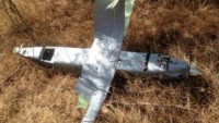 Russian Army to Soon Deploy its first ‘Kamikaze Drones'
 DARPA Program Allows Swarms of U.S. Aerial Drones to Collaborate in Attacks
 Thought-Controlled Aerial Drone Successfully Flown


EDITOR'S PICKS
-

Did the Trump administration just announce plans for a trade war with ‘hostile’ China and Russia?
-

US Senate passes Taiwan travel bill slammed by China
-

As Yan Sihong’s family grieves, here are other Chinese students who went missing abroad. Some have never been found
-

Beijing blasts Western critics who ‘smear China’ with the term sharp power
-

China Envoy Seeks to Defuse Tensions With U.S. as a Trade War Brews
-

Singapore's Deputy PM Provides Bitcoin Vote of Confidence Amid China's Blanket Bans
-

China warns investors over risks in overseas virtual currency trading
-

Chinese government most trustworthy: survey
-

Kashima Antlers On Course For Back-To-Back Titles
MOST POPULAR
LATEST NEWS
Zhou Yongkang: China's Former Security Chief Sentenced to Life in Prison

China's former Chief of the Ministry of Public Security, Zhou Yongkang, has been given a life sentence after he was found guilty of abusing his office, bribery and deliberately ... Full Article


TRENDING STORY

China Pork Prices Expected to Stabilize As The Supplies Recover
-
Elephone P9000 Smartphone is now on Sale on Amazon India
-
There's a Big Chance Cliffhangers Won't Still Be Resolved When Grey's Anatomy Season 13 Returns
-
Supreme Court Ruled on Samsung vs Apple Dispute for Patent Infringement
-
Microsoft Surface Pro 5 Rumors and Release Date: What is the Latest?