China Launches World's Most Sophisticated Observation Satellite
| Ryan General | | Dec 30, 2015 08:48 AM EST |
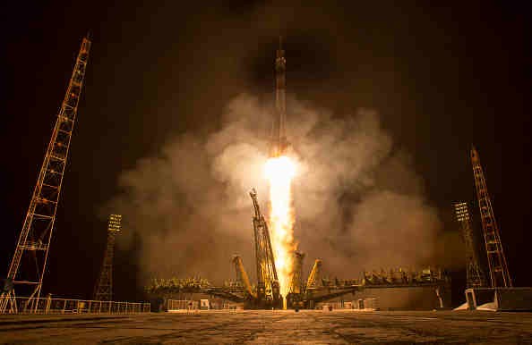
(Photo : Gettyimages) Gaofen-4's launch was the 19th space mission for China this year. SASTIND says it is designed to be used for preventing disasters and rescue and surveillance as well as weather forecast.
China closed the year 2015 by launching Gaofen-4, the most sophisticated observation satellite on Tuesday, as part of the country's high-definition (HD) planet observation project. The Gaofen-1, the pioneering satellite of the project, was launched in 2013.
The Chinese space agency State Administration of Science, Technology, and Industry for National Defense (SASTIND) launched Gaofen-4 from the southwestern province of Sichuan in the Xichang Satellite Launch Center. It is the 222th flight of the Long March rocket series using Long March-3B carrier rocket.
Like Us on Facebook
The Xichang Satellite Launch Centre also houses facilities such as the Launch Control Centre, propellant fuelling systems, telephone and data communications for users, communications systems for launch command, and support equipment for meteorological monitoring and forecasting.
SASTIND and China National Space Administration head Xu Dazhe describes Gaofen-4 as China's first HD optical imaging, geosynchronous orbit satellite, and the earth's most hi-tech HD remote sensing satellite.
Gaofen-4's launch was the 19th space mission for China this year. SASTIND says it is designed to be used for preventing disasters and rescue and surveillance as well as weather forecast.
Unlike the previous satellites Gaofen-1 and Gaofen-2 which are currently in low orbits (600-700km) around the earth, Gaofen-4 is situated at a distance of 36,000km away in orbit from the earth and moves synchronously with the planet. It has a powerful CMOS camera that can "see" an oil tanker on the sea, reaching the best imaging level among global high-orbit remote sensing satellites.
According to NASA, the satellite's main goal is to bring NRT (Near-Real-Time) monitoring for climate change, mapping geographical locations, surveying planetary resource, as well as accurate support for agriculture.
TagsObservation Satellite, China Launched HD Earth Observation Satellite, Most Sophisticated Observation Satellite, Successful Launch Of Gaofen-4
©2015 Chinatopix All rights reserved. Do not reproduce without permission
EDITOR'S PICKS
-

Did the Trump administration just announce plans for a trade war with ‘hostile’ China and Russia?
-

US Senate passes Taiwan travel bill slammed by China
-

As Yan Sihong’s family grieves, here are other Chinese students who went missing abroad. Some have never been found
-

Beijing blasts Western critics who ‘smear China’ with the term sharp power
-

China Envoy Seeks to Defuse Tensions With U.S. as a Trade War Brews
-

Singapore's Deputy PM Provides Bitcoin Vote of Confidence Amid China's Blanket Bans
-

China warns investors over risks in overseas virtual currency trading
-

Chinese government most trustworthy: survey
-

Kashima Antlers On Course For Back-To-Back Titles
MOST POPULAR
LATEST NEWS
Zhou Yongkang: China's Former Security Chief Sentenced to Life in Prison

China's former Chief of the Ministry of Public Security, Zhou Yongkang, has been given a life sentence after he was found guilty of abusing his office, bribery and deliberately ... Full Article
TRENDING STORY

China Pork Prices Expected to Stabilize As The Supplies Recover

Elephone P9000 Smartphone is now on Sale on Amazon India

There's a Big Chance Cliffhangers Won't Still Be Resolved When Grey's Anatomy Season 13 Returns

Supreme Court Ruled on Samsung vs Apple Dispute for Patent Infringement

Microsoft Surface Pro 5 Rumors and Release Date: What is the Latest?


